
Barberton ZIP Code Directory Coverage
Official Barberton City, court, library, and post-office listings support one principal Barberton ZIP code: 44203. It is the right starting point for a Barberton address, but it is not a promise that every address with that code sits inside the City of Barberton. Barberton postal zones move mail, while government records rely on other boundaries and identifiers. The research did not verify a separate Barberton ZIP or a current polygon that marks every place where 44203 crosses a municipal line, so this ZIP code directory names only the postal coverage that official sources support.
| Verified ZIP code | Barberton-area use | Postal location | Record-search caution |
|---|---|---|---|
| 44203 | Principal mailing ZIP on Barberton City, court, library, and post-office listings | Barberton Post Office, 531 Wooster Rd. W., Barberton, OH 44203-9998 | Verify the specific address. The ZIP does not prove city limits, school district, ward, parcel jurisdiction, or physical presence. |
USPS also addresses the Norton Post Office as Barberton, OH 44203-9998. That is concrete evidence that postal geography crosses the Barberton and Norton area. Do not add nearby Akron or Summit postal codes to a Barberton record search merely because a marketing map places them close to Barberton. A postal label is a routing tool, not a local-boundary map.
Verify a Barberton ZIP Code
Use an exact Barberton street address in USPS ZIP Code Lookup before using a ZIP code as a property-search filter. This is especially important when a Barberton tax record has a mailing city or ZIP that differs from the parcel's physical location. Keep the full Barberton address that USPS returns beside the current property record. Then use the property portal's situs and jurisdiction fields for the government-record route. The postal result narrows a search, but it does not replace the parcel number or legal description.
The assigned USPS Barberton Post Office capture documents the local postal context for this ZIP code directory.
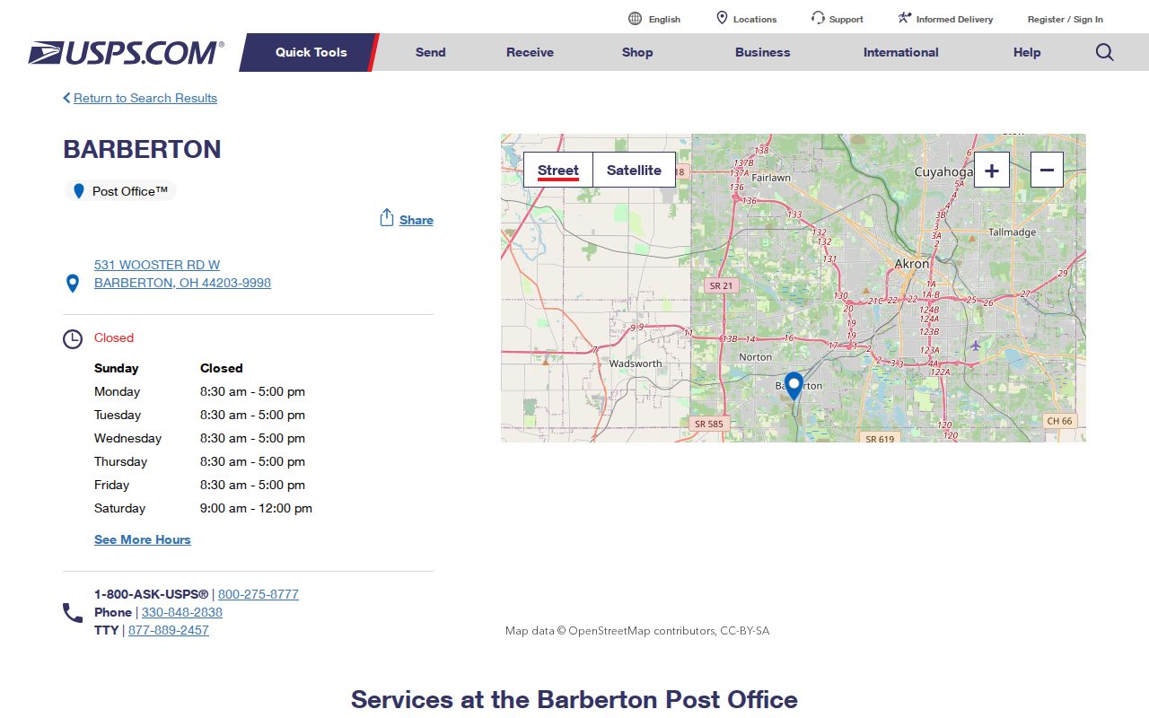
The Barberton Post Office listing confirms the postal location, while an individual Barberton address still needs USPS verification. If the result conflicts with a property mailing line, preserve both results and use the situs address and parcel information to decide which record custodian to contact.
Barberton ZIP Code Property Filters
Summit Property Public Access includes ZIP as an interface label, alongside parcel, route, owner, address number, street, tax year, and sorting controls. That makes the ZIP code useful for narrowing a Barberton property query. The official guide does not say that a ZIP search returns a complete Barberton-wide list or that it can resolve a Barberton boundary dispute. Start with a Barberton address or parcel when possible, then use ZIP as a second check. The GIS viewer also begins with a parcel number, owner name, or street address, not a ZIP-only map mode.
| Summit search field | Role in a ZIP code search | Local limitation |
|---|---|---|
| ZIP | Five-character Barberton postal narrowing field | Does not define a city, court, parcel, or assessment boundary. |
| Address No. and Street | Matches the physical Barberton address components | Directions and suffixes may need comparison with historic records. |
| Parcel | Direct property-system key | Use the exact selected parcel, not a broad ZIP result, for reports. |
| Owner | Property relationship search field | Match it to situs and parcel data; it is not proof of physical presence. |
| Tax Year and Sort By | Year and result-display choices | Selected year matters when comparing Barberton tax information. |
The Summit County house-numbering authority lists Barberton in its service area and is the better route for a new or changed address question. It directs address-work inquiries to Community and Economic Development Planning/GIS. That authority determines an assigned address through its workflow; it does not turn a ZIP code into a parcel boundary.
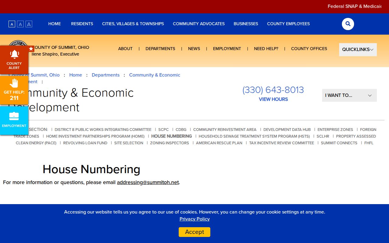
For a Barberton address request that does not render online, the research gives Planning/GIS contact information at 330-643-8013 and addressing@summitoh.net. Preserve an old Barberton address form as printed when it is being compared with a new certificate or parcel screen.
Find Records Within a Barberton ZIP
A Barberton ZIP code search works when it leads to a more exact record key. The property portal can accept a ZIP label, but a Barberton ZIP result must be narrowed to a selected parcel and address before reports are read. The voter tools take a different route: Ohio's individual lookup requires first name, last name, and county, and may use a street name later only to narrow that individual search. It does not begin with ZIP. The postal code therefore helps validate a Barberton address, not create a person-by-person list.
- Enter the full Barberton address in USPS lookup and retain the returned ZIP code and city wording.
- Use the Barberton address, parcel, or selected ZIP field in Summit Property Public Access. Select the Barberton parcel whose situs, district, and record details match.
- Compare the Barberton property record's situs address, mailing address if shown, and parcel or legal-description information. They answer different questions.
- Use the Summit County GIS Viewer with the selected Barberton parcel or street address for map and parcel context.
- Move to the Barberton Recorder, permit custodian, planning file, or dated directory only after the address and parcel relationship are established.
Once a ZIP code narrows the search to a street, use the Barberton street directory for the fuller address-to-parcel and deed workflow. That route has the detail needed for records attached to a named street.
Barberton ZIP Code Boundary Limits
Postal boundaries and city limits do not describe the same thing in Barberton. A Barberton ZIP code routes mail. A Barberton situs address identifies where land is. A mailing address identifies where notices go. A legal description identifies the recorded land unit, and a parcel number identifies it in the Fiscal Office system. Wards, school districts, assessment districts, court coverage, and municipal limits use still other lines. The Norton post-office example within 44203 shows why an address with Barberton postal wording must still be checked against the Barberton parcel and jurisdiction record.
- ZIP code
- A postal routing code used to deliver mail. It does not define a property or municipal boundary.
- ZIP+4
- An added postal segment that helps route mail more precisely. It is not a property-record identifier.
- PO-box ZIP
- A ZIP used for post-office boxes. It is a mailing designation, not evidence of a physical street location.
- Unique ZIP
- A ZIP assigned to a single institution or high-volume recipient. None was verified for Barberton in the research.
- Carrier route
- A delivery sequence used by the postal service. It is not a city-limit or parcel layer.
Historic Barberton ZIP Code Geography
Older Barberton address research needs the period's local grid, not a modern mailing assumption. The 1939-40 Barberton directory says the Pennsylvania Railroad divided east and west streets. Its north-south line ran through the Robinson Avenue center line, extended west to Wooster Road near 16th Street and then to the corporation line west of Gale Drive. A Barberton street section can also state a street's orientation, sides, and house-number sequence. Keep those printed directions beside the Barberton address when working with a historical directory, deed, or map.
The same volume separates Barberton city information, street entries, and alphabetical names. The earliest digitized Burch-era 1892-93 book treats Barberton as a business directory rather than a full household directory. By 1939-40, the printed Barberton sections provide a more useful dated address framework. A present ZIP code should never be used to overwrite the street direction or place label printed in an older source.
Johnson's Corners and Barberton ZIPs
Johnson's Corners was a Norton Township community before its 1929 annexation into Barberton. New Portage is another older geographic label that can appear in records around the present Barberton city. A Barberton historical address, cemetery reference, tax entry, or directory listing may therefore be indexed under Norton Township, Johnson's Corners, New Portage, Summit County, or an Akron-area combined directory instead of the current Barberton label. This is a local retrieval issue, not proof that an old record has a different modern ZIP code.
Keep the original place name, street spelling, directional cue, parcel number if known, and date in the search notes. No verified citywide Barberton renumbering year or ZIP realignment year was found in the research. Comparing the original source wording with a plat, legal description, and current parcel is more reliable than inventing a conversion.
Barberton ZIP Code Record Keys
After Barberton postal verification, records have to be searched by the key each custodian recognizes. The Fiscal Office uses Barberton parcel, address, owner relationship, tax year, and legal-description context. The Recorder relies on parties and document references, with the actual image or counter copy needed for a conclusion. Barberton building and inspection files need a project address, date range, and record type. Planning and plat matters can need a subdivision or legal-description key. Historic Barberton street listings are tied to the edition's date and geography.
For a Barberton public record that has no searchable online index, start with the custodian rather than trying unrelated ZIP filters. The City public-records policy and Summit County's request route both support requests for existing, identifiable records. Ohio R.C. 149.43 requires prompt inspection and copies within a reasonable period, subject to exemptions. State the exact Barberton address, parcel, document type, and time period when available, and request the public portion or a redacted copy where appropriate.
Barberton ZIP Code Search Scale
Barberton's compact geography is another reason to keep postal and government record keys separate. The Census Bureau's QuickFacts profile reports 25,191 residents in the 2020 Census, a 2025 estimate of 24,748, 9.02 square miles of land area, and 2020 density of 2,793.7 people per square mile. A small city can still contain several historical geographies, tax districts, street conventions, and postal routes. A precise street number and parcel remain more useful than a broad ZIP-only query.
The Census QuickFacts profile for Barberton is the source for the local scale shown below.
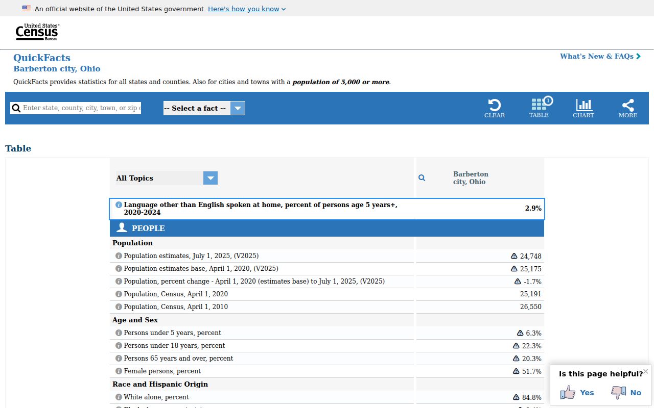
Use Barberton city-scale figures as context only. They do not resolve a specific Barberton mailing address, parcel, or record-custody question. USPS, the property portal, GIS viewer, and the relevant public office each answer a narrower part of that work.